Quality control for satellite images to improve solar irradiance retrieval
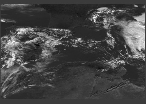
This work was carried out as a mini-project, as part of the original RESTORE-2050 project, for which the model domain was extended beyond Europe, to Sahara, to estimate the potential for deploying cost-effective solar energy in this large desert area. Sahara, one of the world’s largest deserts, is considered an attractive site for harnessing solar energy, due to its abundant year-round insolation and availability of large surface areas that are rarely useful for other purposes (such as agriculture or sustaining civilization). In fact, the entire desert has a potential to produce more than 22 billion GWh of solar energy per year. Also, the abundance of direct normal irradiance (due to rare cloud conditions) over this region makes it a perfect site to deploy large-scale concentrated solar power (CSP) technology. In practise, however, this requires long-term analysis of solar irradiance over the entire region of interest. Due to the lack of available ground-based sensors, usage of satellite images to retrieve cloud information and correspondingly calculate solar irradiance is ideal in this case. For this purpose, Meteosat satellite images were used to calculate solar irradiance time-series. Two generations of satellites (Meteosat First Generation [MFG] and Meteosat Second Generation [MSG]) were operational during the simulation period with the former covering 2003-2005 and the latter covering a time period of 2005-2012. To our dismay it was identified that the existing algorithm to retrieve solar irradiance from MSG satellite required some improvements. As a reference, images from MFG satellite were used for the overlapping year of 2005, and it was immediately identified that the existing database of MSG satellite had some corrupted images, which include images with strange artefacts and some problems with the image headers. There were also frequent occurrence of sudden dips around local noon times in Spring and Fall that were completely absent when MFG dataset was used instead. Our investigations suggested that these were the effects from certain anisotropic effects, that arise from the sun-satellite geometry. They can often cause a sudden brightening of the images, which are misinterpreted as detection of clouds. As a work-around, the albedo was recalculated over a group of 10-days instead of the usual 30-days, to ensure grouping over days with similar reflectivity patterns, for the Spring and Fall months. For further quality control, images with strange artefacts and corrupted headers were also removed and the time series was interpolated to take care of the missing time stamps. As a result of this newly calculated albedo, a comparison between the original and the updated time series showed a correlation coefficient of around 0.983 during Spring and Fall, and remained as high as almost 0.999 for the other seasons. With the deployment of these steps, the quality of the direct normal irradiance, and by extension the power from CSP plants, were largely enhanced, and so did the capacity factor for each year from 2005-2012.